Where: Likely, BC
When: September 19-22, 2008
What: The best paddling festival in western Canada, hands down! Hosted by Adrenalin Mountain Adventures the crew at Red Shred's Bike & Board Shed, for paddlers of all levels.
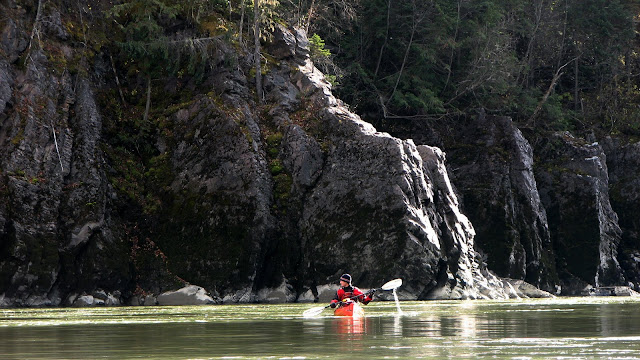
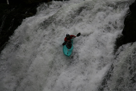
Rivers: From easiest to more difficult, the Lower Cariboo (grade II-III), Upper Cariboo (grade III-IV), Upper Quesnel (grade III-IV), as well as the Chilko River (III-IV) on Monday. At paddlefest levels, there’s a super fun easy surf wave at the top of the Upper Quesnel, that you can park n’ play at all day. For macho gnar-boaters there’s also Cariboo Falls (grade IV-V) at the top of the Upper Cariboo River. Don’t forget that Quesnel Lake is right at the festival site --- great for flatwater practice, total beginners, fishing, canoeing, or whatever.
Camping: Most people camp right in town, but some stay at Quesnel Forks, while others in Cedar Creek Provincial Campground or lodge in Likely. All the action is right out of town, so this is usually the best place to be. Plus you can stumble out of the Hilton in the evening and end up at your tent easily.
Friday Night: Show up and set up your tent, then meet old and new friends while a DJ spins at the Hilton.
Saturday: Paddling all day with organized shuttles. A rafting company may be around as well.
Saturday Night: The Gold Diggers Ball! Yes this is the theme of the weekend. It’s to commemorate the gold miners who came through during the gold rush and who lived at Quesnel Forks (now a nearby ghost town) and in Likely. There is a parade to kick off the festivities, so bring a costume and get ready to party down. Dinner is served at the Hilton by Gecko Tree Cafe, followed by the raucous funk sounds of Mamaguroove until the wee hours. Guaranteed booty shaking freakshow!
Sunday: Brunch served at the Hilton by Bluespoon, then paddling all day with organized shuttles. Later in the afternoon there will be a BBQ at Quesnel Forks served by the Likely Firehall.
Monday: Chilko River trip, shuttles will be arranged by those participating, departing at 9am Monday from Williams Lake and returning around 9pm. Here's a short video of Ben Pittman on Bidwell Canyon, the biggest rapid on the Chilko:
Cost: There is no cost to camping in town or at Quesnel Forks. Cost for the organized shuttles is by donation --- please be generous! All meals will cost $7-10.
Kayak Introduction Course: Captain Holiday's Kayak & Adventure School will be there to do a 2-day introduction to kayaking course. Don provides everything you need - kayaks, paddles, helmets, lifejackets and wetsuits, and absolutely fun and expert instruction. Pre-registration is strongly encouraged, so call him toll free at 1-888-905-2925 to reserve your boat.
More Info: Call Mark at Red Shreds (250-398-7873) or call Ivan (250-989-2100). Apparently there will also be 50 T-shirts this year available for sale from Mark.
 The Lower Willow River is the staple whitewater run for Prince George paddlers. When levels are right, it has a couple great little playspots: Surf City and Diamond Wave. Both have good eddy service and trails right to them for easy park n' play. Depending on the level, these playspots are a whole lot of fun.
 Diamond Wave and Surf City are the classic playspots in the PG area. While not comparable to some of the big waves in our region like Dogdish on the Kalum, the Lower Quesnel put-in wave, Mo-Town on the Bulkley, or god forbid Tatlow Falls, these can serve up some nice fun rides.


 The Brigade 2008 Young Gun of the Year award winner, Luke Borserio, also fired up Overlander, as did Kim Ward-Robberts:
 Good job gang!! I just got back from an awesome trip to Savary Island and Tofino, and had a few days of good surf in the sunshine --- a rare event for the west coast. Pictures below are from Cox Bay.
 Otherwise, local river levels are at the low late season point around Prince George, and it's getting much colder so incentives to get on the water around home have been low. We'll have our Annual General Meeting sometime in Novemeber, so stay posted for more info. That's all for now. Enjoy the fall!!
 The Isle Pierre Rapids located on the Nechako River is an excellent place to learn some basic whitewater skills. Located just 40 minutes out of Prince George, it's a favorite run among beginners and novices and is a great introduction to big water. The Nechako River drains a significant portion of the central interior of British Columbia. By the time it reaches Isle Pierre, it has a lot of volume which gives it some push in the rapids, formed around several large rocky islands.

 By summer, the Nechako is also a fairly warm river as the area it drains is mostly low and mid elevation watersheds. This is a particularly nice characterisitc when swimming is a possibility. Despite being a strong swimmer, Dan managed to stay in his boat on this run pictured below. Nice work Dan!!
 Apart from Isle Pierre, the Nechako River right in Prince George can also be a decent place to practice skills like eddy turns, ferries, rolls, and all the flatwater moves you can muster. Good times! See you on the river...


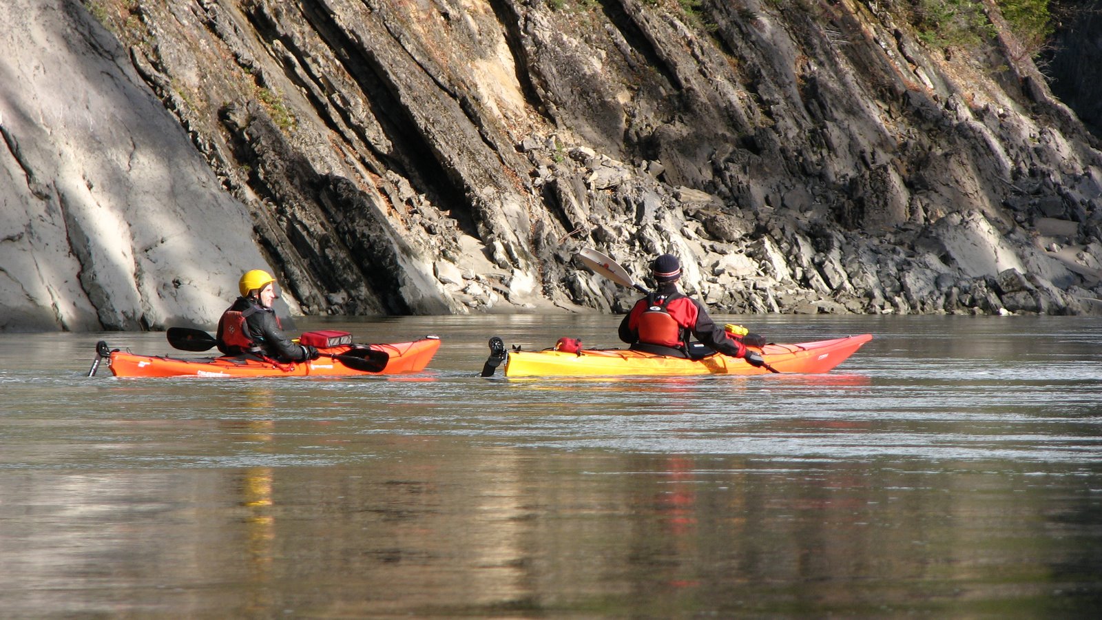
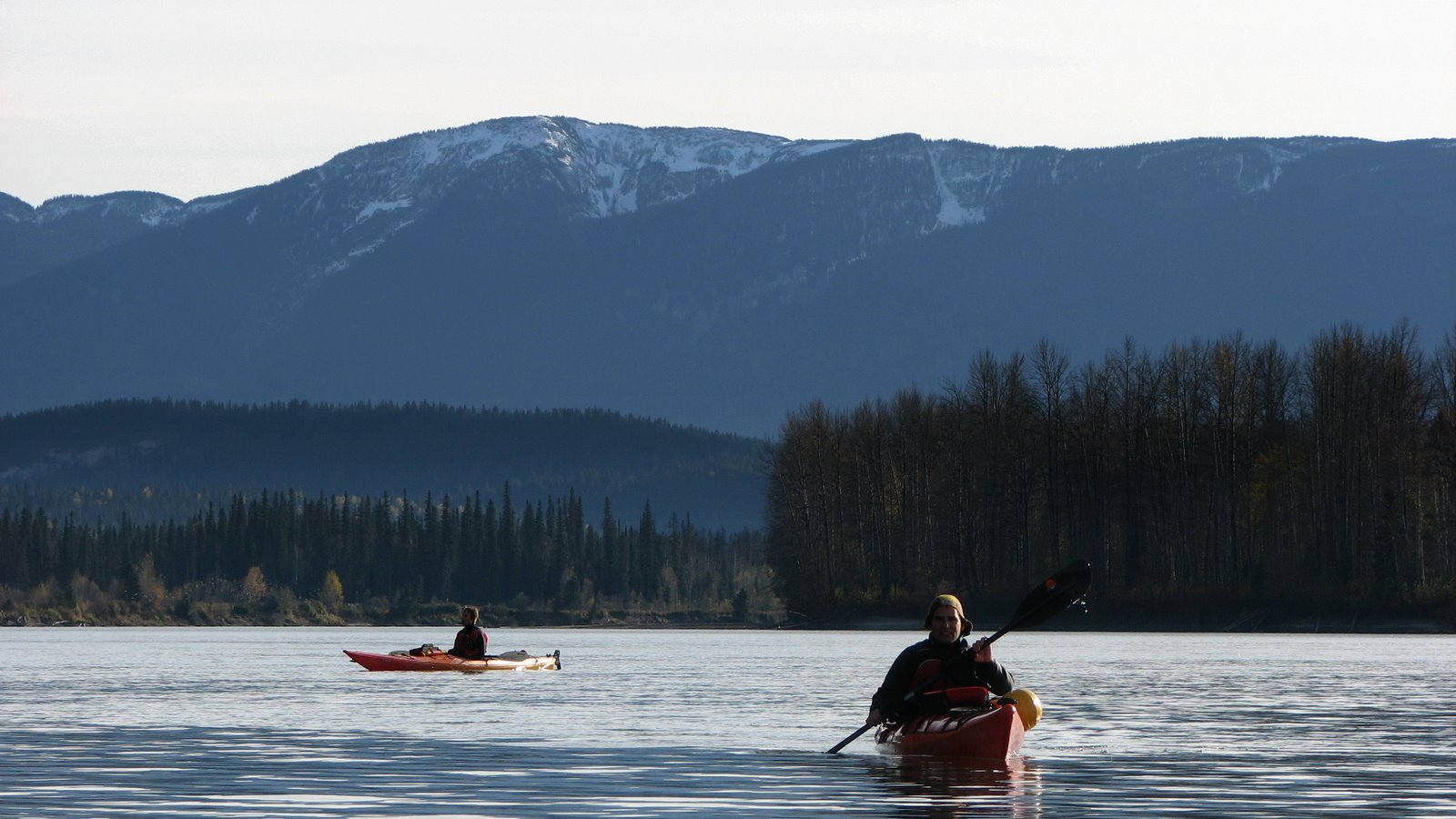
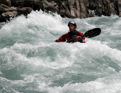
 Sean and Laura made the trip out from Smithers, and Ian and I drove down from Prince George. For mid-August, levels were still pretty high (~6 on the Cariboo, and 0 on the bridge gauge for the Quesnel), and the temperatures were in the low 30s. Lots of play scattered play throughout both runs and quality big water rapids.
  On Saturday night we all went to the McConkey's new place up Quesnel Lake for a BBQ. Hardy and Gretchen were there as well with there lil' jibber Louise. Sunday, Trevor even managed to make it out for a surf session at the put-in wave. I'm not gonna flap about the rapids much here though. Instead, I made a video of all the named rapids on the Upper Quesnel which you can check out here:


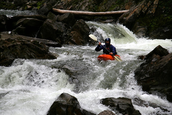
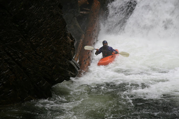
 Following Shithouse was Eric's Hole --- a massive drop on river left that you would likely never emerge from. The line was this cool creeky bouldery sneak on the right that spits you out into the huge wave train below Eric's. After this a lot of the named rapids became a blur that Ian, Hardy, or Ed gave beta on, including Boulderdash, Holy Terror, Toilet Bowl, Otter Slide, and Staircase, all grade III+ to IV-. There were also busy stretches of grade III whitewater between the named rapids that gave the entire run a very continuous feel. The only close-call of note would be at Otter Slide, where Hardy, Amanda, Rick and I ended up way too close together above the drop. By the time I got some space and began paying attention to my line, I was way off and ended up pitoning into this jumble of boulders beside Amanda. Kind of terrifying! But also a little funny. Luckily with a little effort I was able to free myself and stay in my boat, and then share a big "wtf?" laugh in the eddy with Amanda.
 Ian's actually run the falls a couple times, as well as lots of descents through the Upper Canyon. Unfortunately he recently put a hole in his ear creeking, and so flipping isn't an option until he heals up. This also explains the full-face in the above picture, but I can't explain the moustache other than it's totally legit.
 The Canyon is a step-up from the rest of the run, with numerous grade III-IV rapids leading into Terminator. After Graham traded his playboat for Ed's creeker, he lead Hardy, Amanda, and Mike into the Canyon while the rest of us hiked out to Hargreaves to set up for pictures. It was pretty awesome to see everyone run this. To avoid the meatiest part of the drop, you had to get up on this massive ramping pillow on far river left and punch the hole at the bottom. Some had good lines like Mike and Amanda, and others not so good. Here's a bunch of pix of Terminator:
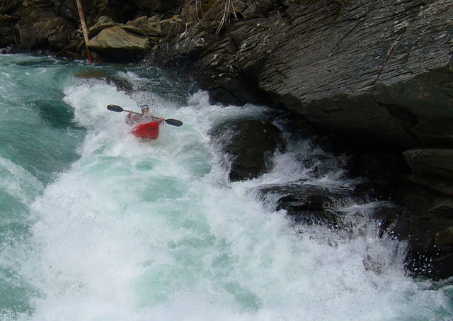


 The last stretch to the take-out is a full-on blast through a number of very pushy drops that you can see looking upstream from Hargreaves Bridge.
 High fives in the sunshine all around at the take-out! Really couldn't think of any other place I'd rather be. Great run, and thanks to everyone on the trip, especially Ian, Ed, and Hardy for the guidance, and Rick and Amanda for driving. Also big thanks to Ian and Rick for the great pictures.
 That's all for now. Happy paddling and here's to the rest of your summer --- cheers!

 As with most rivers, the biggest hazard is wood. This years floodwaters brought in heaps of new logs, most of which we encountered in the first few kilometers. Levels were still very high as the picture below taken from the put-in bridge shows:
 Scouting in the canyon was manageable, with decent eddies throughout. Below is Al Leighton eddying out after portaging a log-choked rapid about 2 km below the put-in:
 Picture below is our lunch spot --- a rock in the middle of the river to avoid the fierce mosquitos. Note the log just above water level in the background.
 The character of the river is continuous pool-drop grade II-II+ rapids, with a number of grade III rapids throughout.
 There is also one flatwater stretch before the final canyon. However, with the high flows and nice scenery, it went by quickly. Parts of the canyon are over 200 meters deep, as seen below:
 The final canyon is the most impressive, and also has the most challenging whitewater. We hiked up on river left to scout this one, which was a bit of a bush-whack but a good call nonetheless. There was one river wide log at water level about half way through. Here's a couple shots below of T-Star looking sharp for the birdie:
 Note on the take-out: modern short kayaks and high levels on the Fraser River basically make getting to the normal take out as written in our guidebook impossible. A couple years ago, we found a new take-out trail that is now the preferred alternative. From ~ 16.5 km on the Tako Road, head south on the Tako "F" Road, staying on the main "F" road. This year they've fixed the road, and now there's only one short section about 200 m from where you park that requires 4 x 4. The trail head at the parking spot has old signs, and leads all the way down to the Blackwater ~ 500 m upstream of the Fraser River. To recognize this while on the Blackwater, look for a bunch of pink ribbon on river left about 1 km past the final rapid, about ~ 500 m past a cable-trolley carriage that crosses the river. Follow the quad trail from the river to the parking spot --- a solid 30 minute hike uphill.